
Our Learning History:
How we got to where we are today
Restoration and Revitalization with Milone & MacBroom, Inc. 2012-2013
Hoosic River Revival worked with consulting and engineering group Milone & MacBroom, Inc. (MMI) to develop a series of design options that would retain the same level of flood protection while also improving ecological conditions. These conceptual plans divided each branch of the river into smaller sections, looking at different options for how to reimagine each segment. Each alternative for was later rated by how feasible the plan would be. Parameters for the grading related to river hydrology, urban design, and implementation.
MMI determined that the flood chutes succeeded in protecting North Adams from devastating damage during Tropical Storm Irene in 2011. Their report stated that the chutes along the North Branch filled to around 50% of their maximum capacity, whereas the South Branch chutes were a third full during the storm.
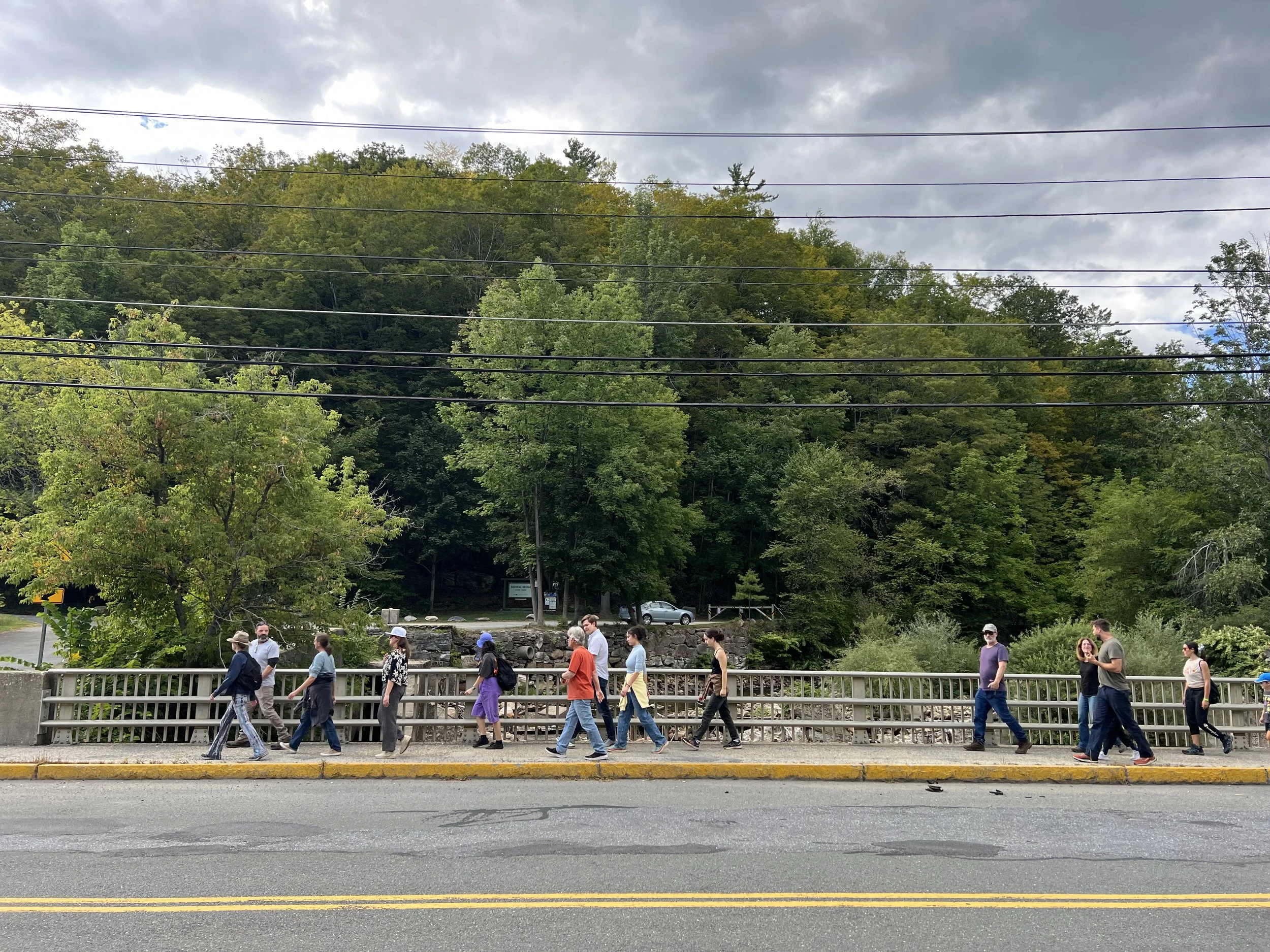
Designs were influenced by a community conversation session in 2010 where residents came up with and supported ideas like a continuous path along the river, spaces for public art and recreation, and a better connection between the river and the city.
Discovery of Falling and Leaning Walls 2017
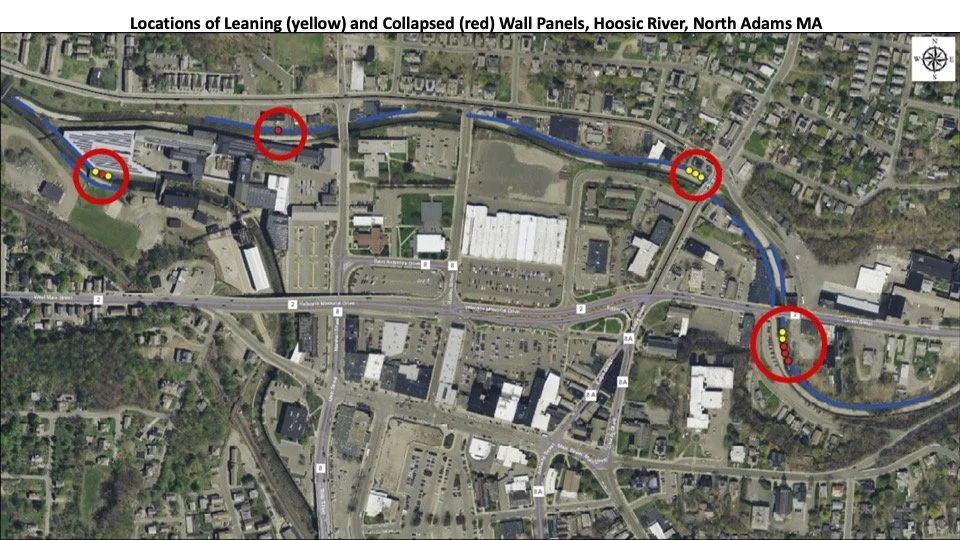
Map above shows locations of either leaning or collapsed flood chute panels in 2017.
It became apparent in 2017 that the then 60 year old flood chutes were showing signs of aging. In multiple locations along both the North and South branches panels along the walls of the chutes were either collapsing or leaning. Investigation into these locations found that these panels were not structurally sound.
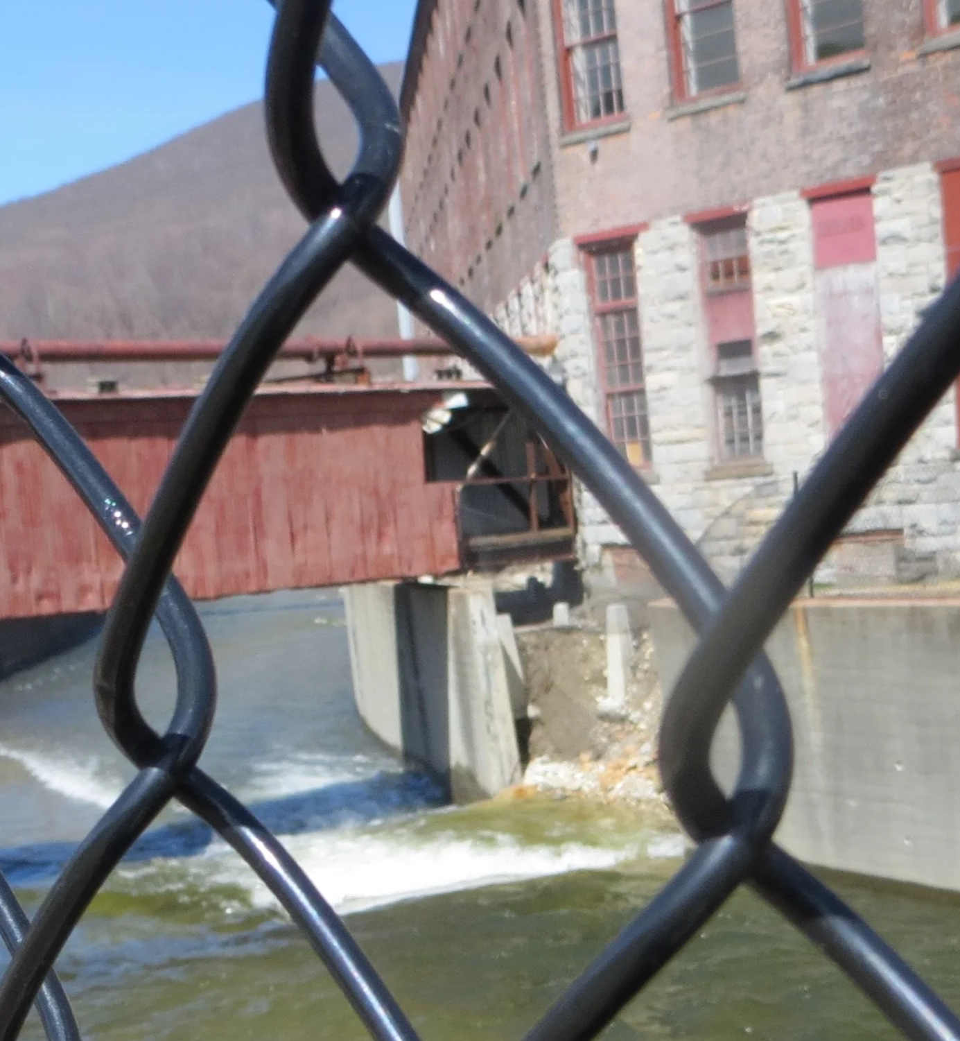
Collapsed wall panels along Hoosic River
Conceptual Plans by Architecture Firm Sasaki 2015 & 2018
In 2015, we worked with the architecture firm Sasaki to develop a conceptual plan along the South Branch of the Hoosic River. This plan was guided by four areas of improvement: ecological, recreational, cultural, and economic.
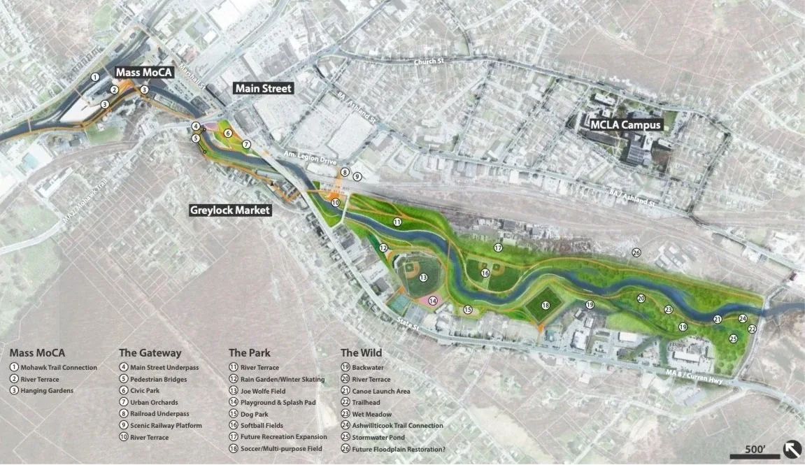
Conceptual plan developed by Sasaki Architects in 2015. Their vision breaks the South Branch into 4 segments: Mass MoCA, the Gateway, the Park, and the Wild. Each section would contain different features that relate to the four guiding themes of improvement.
We once again worked with Sasaki in 2018, this time focusing on the North Branch of the Hoosic River.
Their study was centered around the goals of maintaining or improving safety, restoring riparian ecology, and reconnecting the community with the Hoosic.
Like the 2015 plan, the North Branch conceptual plan divided the river into sections, each with various river attractions or uses. Additionally, their plan outlines the flood resiliency of each segment, detailing the frequency of different flood depths at each location
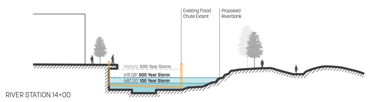
Example of how Sasaki modeled various flood levels against the existing chutes and proposed changes to the riverbank in their 2018 conceptual plan.
At the end of their 2018 study, Sasaki outlined steps for how to move forward with this project, including collaborating with the US Army Corps of engineers on a feasibility study.
Feasibility Study: US Army Corps of Engineers and City of North Adams 2023-2026
Over the past few years, we have worked with the US Army Corps of Engineers and the City of North Adams to complete a study of potential river improvements. The purpose of the report was to “identify, evaluate and recommend to decision makers an appropriate, coordinated and workable solution to identified water resources problems and opportunities.”
The Feasibility Study cost roughly $3 million. Half of this came from federal funds, and the remainder was split between city and state.
The feasibility study focused on plans that met the S.M.A.R.T. guidelines.
S: Specific
M: Measurable
A: Attainable
R: Risk Informed
T: Timely
With our feasibility team, we developed 3 goals: increase flood risk mitigation for our aging flood control system, improve the quality of the water for wildlife, and create a community asset for the city. As part of our community engagement commitment, we adopted a focus on placemaking.
PLACEMAKING: to create riverfront places the community loves and feels connected to, places that will promote our health, happiness, and well-being